 OneGeology catalogue
GBR BGS Soil depth from boreholes
"The BGS holds over a million borehole records and these can be viewed online in the dedicated borehole viewer ( https://www.bgs.ac.uk/data/boreholescans/home.html). Coverage across Great Britain is clustered (generally within urban centres and corridors). This map only shows borehole data that has been captured to date (additional data may exist).
Boreholes are drilled for assessing ground conditions for construction, water and mineral resources. They are generally not drilled for the purpose of recording soil information. However, many boreholes note the depth of deposits classed as 'Topsoil' and so BGS has started to compile a dataset of reported 'Topsoil' depths. Most records suggest that the driller has identified a generic 'Topsoil' layer. Some records provide further details that indicate the topsoil layer has differing properties, or is not solely a topsoil layer but a combination of soil and other materials (e.g. parent material, peat and artificial ground). Users should therefore be aware that the term 'topsoil', as used in borehole records, should be regarded as a very simple description of what soil-scientists might regard as a combination of O, A, E and possibly B horizons."
Simple
- Date (Revision)
- 2022-04-08T08:34:54
- Status
- Completed
- Point of contact
-
Organisation name Individual name Electronic mail address Role British Geological Survey
Garry Baker
enquiries@bgs.ac enquiries@bgs.ac.uk
Point of contact
- Theme
-
-
Map
-
Geology
-
Soil
-
Borehole
-
Parent material
-
Soil depth from boreholes
-
OneGeology
-
continent@Europe
-
subcontinent@Northern Europe
-
geographicarea@United Kingdom of Great Britain and Northern Ireland
-
dataprovider@British Geological Survey
-
serviceprovider@British Geological Survey
-
DS_TOPIC@geoscientificinformation
-
DS_DATE@2022
-
thematic@Soil
-
thematic@Pedology
-
thematic@Borehole
-
- Denominator
- 14174.107143
- Denominator
- 236235.119048
- Topic category
-
- Geoscientific information
))
- Reference system identifier
- CRS:84
- Reference system identifier
- EPSG:4326
- Reference system identifier
- EPSG:4258
- Reference system identifier
- EPSG:27700
- Reference system identifier
- EPSG:3857
- Distribution format
-
Name Version
- OnLine resource
-
Protocol Linkage Name OGC:WMS-1.3.0-http-get-map
https://map.bgs.ac.uk/arcgis/services/UKSO/UKSO_BGS/MapServer/WmsServer? Soil.depth.from.boreholes
application/xml
http://metadata.bgs.ac.uk/geonetwork/srv/en/csw?SERVICE=CSW&REQUEST=GetRecordById&ID=9df8df52-d7c7-37a8-e044-0003ba9b0d98&elementSetName=full&OutputSchema=http://www.isotc211.org/2005/gmd& Soil.depth.from.boreholes (MetadataURL)
image/png
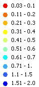
https://map.bgs.ac.uk/BGS_WMS/legends/soilproperties/soil_depth_from_boreholes.png Soil depth from boreholes (LegendURL)
- Hierarchy level
- Dataset
- File identifier
- 4ca3b2e76dd4d05f635dbaf59fce55c56a7e77bf XML
- Metadata language
-
eng
- Character set
- UTF8
- Hierarchy level
- Dataset
- Date stamp
- 2022-04-08T08:34:54
- Metadata standard name
-
ISO 19115:2003/19139
- Metadata standard version
-
1.0
- Metadata author
-
Organisation name Individual name Electronic mail address Role British Geological Survey
Garry Baker
enquiries@bgs.ac enquiries@bgs.ac.uk
Point of contact
Overviews


Spatial extent
Provided by
