 OneGeology catalogue
GBR BGS Geochemistry
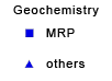
This layer of the map based index (GeoIndex) providex an index to 17,500 borehole rock samples (drillcore) from the Mineral Reconnaissance Programme (MRP) and related studies. The UK Government's Department of Trade and Industry (DTI) funded BGS to provide baseline information on areas prospective for the occurrence of metallic minerals in Great Britain. This programme, known as the MRP, ran continuously from 1973 to 1997 and covered particular locations across Great Britain. It was designed to stimulate private sector exploration and to encourage the development of Britain's indigenous mineral resources. Under the programme a number of boreholes were drilled to gather information.
This layer is only available at specific zoom levels. Please zoom to a larger scale to interrogate the map.
Simple
- Date (Revision)
- 2022-04-08T08:20:09
- Status
- Completed
- Point of contact
-
Organisation name Individual name Electronic mail address Role British Geological Survey
Garry Baker
enquiries@bgs.ac enquiries@bgs.ac.uk
Point of contact
- Theme
-
-
Boreholes
-
GeoIndex
-
Geochemistry
-
OneGeology
-
continent@Europe
-
subcontinent@Northern Europe
-
geographicarea@United Kingdom of Great Britain and Northern Ireland
-
dataprovider@British Geological Survey
-
serviceprovider@British Geological Survey
-
DS_TOPIC@geoscientificinformation
-
DS_DATE@2022
-
thematic@Geochemistry
-
- Denominator
- 236235.119048
- Topic category
-
- Geoscientific information
))
- Reference system identifier
- CRS:84
- Reference system identifier
- EPSG:4326
- Reference system identifier
- EPSG:4258
- Reference system identifier
- EPSG:27700
- Reference system identifier
- EPSG:3857
- Distribution format
-
Name Version
- OnLine resource
-
Protocol Linkage Name OGC:WMS-1.3.0-http-get-map
https://map.bgs.ac.uk/arcgis/services/GeoIndex_Onshore/boreholes/MapServer/WmsServer? Geochemistry
application/xml
https://metadata.bgs.ac.uk/geonetwork/srv/eng/csw?SERVICE=CSW&REQUEST=GetRecordById&ID=9df8df53-2a89-37a8-e044-0003ba9b0d98&elementSetName=full&OutputSchema=http://www.isotc211.org/2005/gmd&version=2.0.2& Geochemistry (MetadataURL)
image/png
https://map.bgs.ac.uk/BGS_WMS/legends/geoindex/geochem.png Geochemistry (LegendURL)
- Hierarchy level
- Dataset
- File identifier
- 7fd13345246564dc37b03556e1ce5e507690cf14 XML
- Metadata language
-
eng
- Character set
- UTF8
- Hierarchy level
- Dataset
- Date stamp
- 2022-04-08T08:20:09
- Metadata standard name
-
ISO 19115:2003/19139
- Metadata standard version
-
1.0
- Metadata author
-
Organisation name Individual name Electronic mail address Role British Geological Survey
Garry Baker
enquiries@bgs.ac enquiries@bgs.ac.uk
Point of contact
Overviews


Spatial extent
Provided by
